steve holmes
Member
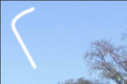
This afternoon (2:09 pm) I saw this contrail. I was about 15 miles east of Sacramento, near the river when I saw it. It was to the north.
It's kind of hard to see in the picture but it first went left (west), then up (I think that would be south), and then right (east). I have more than one picture but this one shows what I'm describing. It's super hard to see the trail but the turning is on the left side of the photo (I tried to play with the brightness and contrast of the picture to make it easier to see, but I couldn't really improve it)

It's kind of hard to see in the picture but it first went left (west), then up (I think that would be south), and then right (east). I have more than one picture but this one shows what I'm describing. It's super hard to see the trail but the turning is on the left side of the photo (I tried to play with the brightness and contrast of the picture to make it easier to see, but I couldn't really improve it)
Last edited by a moderator: